Welcome to the new home of my blog. Here you will find essays on 'overlanding' (I prefer the term 'expeditions',) 'camping,' 'camp cooking,' and all things 'outdoors.'
Every year, my buddy Glenn and I go for a Spring and/or Fall expedition trip to the Utah, Northern Arizona, Western Colorado area, driving mainly off-road between campsites - dispersed, if possible. In this essay, I am providing an insight into how I plan for my trips, with a particular emphasis on the type of tools I use. And before I get the obligatory comments about how *this* or *that* tool is better, has more features, etc., I am aware that in today's day and age, every problem has a multitude of solutions, especially in the digital realm. I am describing my workflow, and the tools I use here; your mileage may vary ;).
With that out of the way, let's dive into it.
Before anything else: Decide on the specific area you plan on visiting
This may sound obvious, but I think it is important to decide early on which specific area to target for exploration. So, while starting out with the idea of "visiting Western Colorado" might sound great, as an area to cover, it is still too large. So, from the first 'broad' idea of what to visit, I typically will start narrowing it down to more manageable parcels. Depending on the goal of the expedition, the specific area may vary. For example, if I plan to visit an area primarily to just relax and camp, I will choose differently than when my expedition goal is to experience the area’s off-road trails, and camping is merely a 'basecamp style' place to start my adventures from...

Let's say for the sake of this essay, we want to start our exploration somewhere between Pagosa Springs and Durango; this is a convenient meeting place for Glenn and I coming from Southern Missouri and Western Iowa, respectively. My main goal then is to find a nicely situated campsite with easy access, preferably on, or at least near, a creek or a lake, to meet up and relax for a couple of days after the two-day trip there, and before continuing. Since our "exploration" in this area is primarily dispersed camping, with possibly some short off-road excursions, I use Google Maps in "Terrain" mode for my general planning purposes. As we see, there is a 'landmark' called "Chimney Rock," which might be worth investigating further. In addition, reading up on the area, there are some thermal springs on the Eastern side of the Piedra river: North on First Fork Road from HWY-160 (this turns into CR 166.) A little further down the road, North of Bayfield, we also have the Vallecito and Lemon Reservoirs, which might be fun to visit, and maybe even switch campsites too.
Speaking of campsites. I use multiple tools, some free, some paid, to find potential campsites in the chosen area. My favorite - and always first stop - is iOverlander. For the planning stage, I prefer the web site, but there are also apps available for both iOS and Android, which can come in handy while on the road. One warning though: a lot of great tools do require cellular coverage, since they pull their data from a server. iOverlander is no different.

Looking at the chosen area for the first stop, while keeping our goals in mind, I can see multiple options for camping.
My next step is typically to look at each of the potential sites and do some research around them - e.g., when on BLM or FS land, I will go to the respective Web site and read up on the area, the jurisdiction, and check out exactly what services are available, what restrictions (e.g. fire bans, number of people or vehicles,) exist, etc.
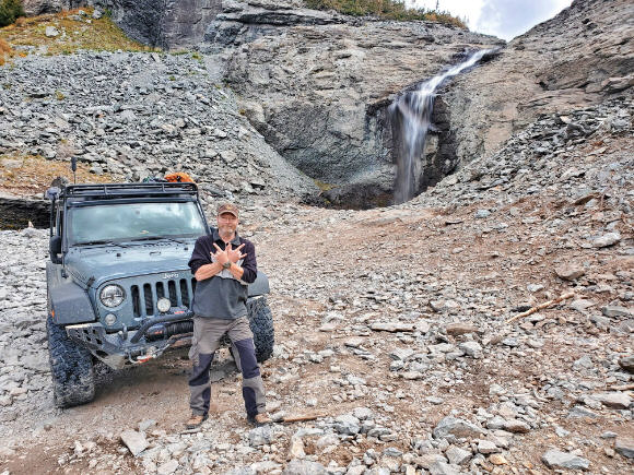
After exploring that area for a while, we'll then continue to the Silverton area. For this part of the trip, I'm switching gears, making the goal exploring the fabulous off-road trails the Jan Juan mountains have to offer. Maybe even add a little hike/scramble to the top of Mt Sneffels into the mix, since driving up to Yankee Boy Basin is on my 'to-do' list anyhow. Since this area is mountainous, and my primary goal is off-roading, with camping 'secondary' just as an FOB, I use a true topographic map for the planning here.

My number one choice for this task is GaiaGPS. Gaia is a paid version of topographic mapping software, with a multitude of map "layers" available for specific outdoor activities. There are overlays showing all the public lands in the country; or the fishing holes in creeks, rivers, and lakes; precipitation forecasts for 12h, 24h, 48h; Trailforks mountain bike trails; etc. While there is a free option, which is already useful, many - IMO - essential map layers are only available in the paid version.
Besides the map overlays, there are overlay views available for one's waypoints, routes, tracks, areas (e.g., user-defined property boundaries, etc.,) as well as public tracks (i.e., tracks others have shared and made "public,") saved trails, and coordinate grid overlays. The list of available maps, the inner workings of Gaia, how to use it, etc. is too long to document here. Suffice it to say all the maps and layers can be downloaded to a mobile device (smartphone, tablet) to work even outside of cellular coverage - which is an essential feature of any software used for backcountry travel/navigation. Check out Gaia Map Overlays, or their blog for more information.
Besides Gaia as my dedicated GPS device replacement, I personally like to carry paper maps with me when in the boonies. Nothing beats the peace of mind of having a paper map and compass in the vehicle in case of smart device failure. Speaking of failure, I do subscribe to Garmin inReach to have the option of 'out of cellular coverage' communication, as well as emergency connectivity, if needed.
In an upcoming essay, I will outline how I deal with “off the grid” communications, mapping etc.
My tool of choice for paper maps is CalTopo/SARTopo. The reason I use SARTopo over Gaia for printing maps is because I want my maps to have a fixed scale I can control. Typically, I print three types of maps for a trip: Trip overview, Area overview, and route-specific maps. As a rule, the 'trip overview' map is typically somewhere in the 1:750,000 to 1:1,000,000 range. These maps usually show the complete route (highlighted) and the area(s) of interest surrounding the routes.
The 'area overview' maps will usually be in the range of 1:250,000 to 1:500,000 and show a slightly more detailed view of the area I plan on exploring. So, in the case above, those maps would show the area between Pagosa Springs and Durango, complete with marked (potential) campsites and exploratory routes.
CalTopo/SARTopo provides many tools and maps for free, including printing maps up to 8.5"x11" (up to 200dpi,) but some of the more elaborate tools do require a subscription: Mobile for $20/year provides offline layers and private maps in addition to the free version functionality; Pro for $50/year adds premium layers and advanced planning tools, and allows for printing up to 36"x48" (up to 400dpi). There is also a "Desktop" subscription for $100/year, which adds a desktop application (instead of working with the maps in a browser,) and GIS tools. I have been using the Pro version of SARTopo in a browser on my desktop for planning purposes, trip archiving, and map printing for years and I can highly recommend it.
Finally, ‘route-specific’ maps typically range in scale from 1:25,000 to 1:100,000. These maps show a detailed topographic view of my intended route and the surrounding area(s), as well as (potential) campsites, points of interest, obstacles, etc. I gather the route information from a multitude of sources, but one of my favorites - and the one I usually go to first - is Trails Offroad.

As you can see in this picture (and following the ‘Trails Offroad’ link,) this community-driven site maps common trails in various regions of the US (this particular screenshot shows the trails around Silverton, Colorado.) While seeing the trails on a map is great, what really sets this site apart from others is the detail in the trail-specific section. Clicking e.g. on Black Bear (the red line above) opens up this page:
Here you find a feature I use all the time: the ability to 'share' the trail details - especially the fact I can 'connect' my Gaia account to my Trails Offroad and send trails directly to my Gaia map. I do the same to print my paper map by downloading the GPX file, and then uploading it to SARTopo, so I have the physical trail line on the map. Besides these features, you can use the 'Directions to Trail' button to be guided either to the beginning, or the end, of your chosen trail using Google Maps. Finally, you can print the information to use offline - you can even choose which sections (cf below) the print should show. I really encourage you to check out that trail review in its entirety. Besides the top section I posted above, the review goes on with the 'Highlights section:' 
After the 'Highlights,' we have a Video shot by a local Trails Offroad member driving the trail, followed by a 7-day weather forecast, and then an important section outlining route information, where we get a detailed explanation of how the Trails Offroad team provides a technical rating of the trail -- and provides ‘All Access’ members the opportunity to add their own assessment to this section.

A quick note here as well. Like GaiaGPS and CalTOPO/SARTOPO, Trails Offroad offers a large portion of its available information for free. There are some sections (and trails,) that are available only to "All Access" members - folks who pay $25/year to help support the site and the work the Trails Offroad team does.
I guess now is a good time to note: I am not affiliated with any of the paid tools I am describing here, I am not endorsed by them, and I do not get any financial - or other - advantage from mentioning them. In fact none of the tools mentioned in this essay have reviewed, or are, as far as I know, aware of it...
After the ‘Route Information’, we have a large section with the relevant waypoints on the trail. The picture above shows two famous waypoints -- with pictures and explanations -- on Black Bear Pass trail: the steps, and Ingram Falls.

After the waypoint section, the GPS coordinates of the trailhead are given, together with a textual rendering of the driving directions from the nearest town (in this case Ouray,) followed by a section about possible camping spots (if applicable) on/near the trail. The final section is user-submitted "Trail Reviews," which can sometimes be very helpful - e.g. an actual user relaying their experience running the trail with a particular vehicle and configuration at a specific time of year...
I hope this walkthrough of my planning process, albeit at a somewhat high level has been helpful. Do feel free to let me know in the comments what you think, and if there is any subject I just scratched the surface on above you would like me elaborate on.
Stay Safe!
Alain.